UN
9 Delmore Road
£ 220,000
Description
We don't have a Description for this property.
- Bedrooms
- 4
- Bathrooms
- 0
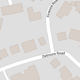

Leaflet © OpenStreetMap contributors
The heatmap indicates the level of crime in the area. The color of the heatmap indicates the crime severity and recency.
Metrics Year-on-Year
- Average area value
- 419,163.00 £Increased by 28.01 %
- Average area rental value
- 1,171.00 £/moIncreased by 54.08 %
- Est rental Yield
- 3.35 %Increased by 20.07 %
- Crime Rate
- 29.00 %Unchanged by 0.00 %
from 327,450.00 £
from 760.00 £/mo
from 2.79 %
from 29.00 %
Nearby Schools
| Name | Type | Ofsted | Distance |
|---|---|---|---|
| Wessex Lodge School | Other Independent Special School | Good | 0.55 KM |
| Avanti Park School | Free Schools | 0.59 KM | |
| Oakfield Academy | Academy Converter | Requires improvement | 0.91 KM |
| Vallis First School | Community School | Good | 0.96 KM |
| St Louis Catholic Primary School, Frome | Voluntary Aided School | Good | 1.05 KM |
Images
Nearby Streets
| Name | Average Price | Average Sqft | Distance |
|---|---|---|---|
| Oakfield Road | £ 0 | 0 | 0.00 KM |
| Morgan's Lane | £ 0 | 0 | 0.00 KM |
| High Street | £ 200,000 | 0 | 0.00 KM |
| Sheppard's Barton | £ 0 | 0 | 0.00 KM |
| Wesley Slope | £ 0 | 0 | 0.00 KM |
Nearby Transport
| Name | NLC | TLC | Distance |
|---|---|---|---|
| Frome | 5707 | FRO | 2.17 KM |
Nearby Listings
| Address | Price | Type | Score | Distance |
|---|---|---|---|---|
| Whitewell Road, Frome | £ 695,000 | BUY | 6 / 10 | 0.13 KM |
| Richmond Road, Frome | £ 280,000 | BUY | 7 / 10 | 0.15 KM |
| Whitewell Road, Frome | £ 415,000 | BUY | 7 / 10 | 0.17 KM |
| Stourton Gardens, Frome, Frome, BA11 | £ 290,000 | BUY | 7 / 10 | 0.19 KM |
| Malthouse Court, Frome | £ 130,000 | BUY | 5 / 10 | 0.21 KM |
Nearby Properties
| Address | Price | Distance |
|---|---|---|
| 9 Delmore Road | £ 220,000 | 0.00 KM |
| 26 Delmore Road | £ 496,000 | 0.00 KM |
| 30 Delmore Road | £ 169,000 | 0.00 KM |
| 25 Delmore Road | £ 420,000 | 0.00 KM |
| 1a Delmore Road | £ 225,000 | 0.00 KM |